I also learned some more quirks about ArcMap. The program is amazing in some ways but user interface is not one of them. I was also unable to figure out how to use two different fields to join my data to the counties shapefile. So that was slightly frustrating but I was able to work around it.
Anyway, until I get around to poking osmosis again,
I give you Colorado:

Colorado has another strong outlier: Teller county with only 35.8% of ways untouched . I didn't look at the data but I believe I know the person responsible for this, in real life even! Hi SpenSmith! Also, as you can see I replaced the "total number of TIGER ways proportional symbol with a few city names for general reference.
On to New Mexico:
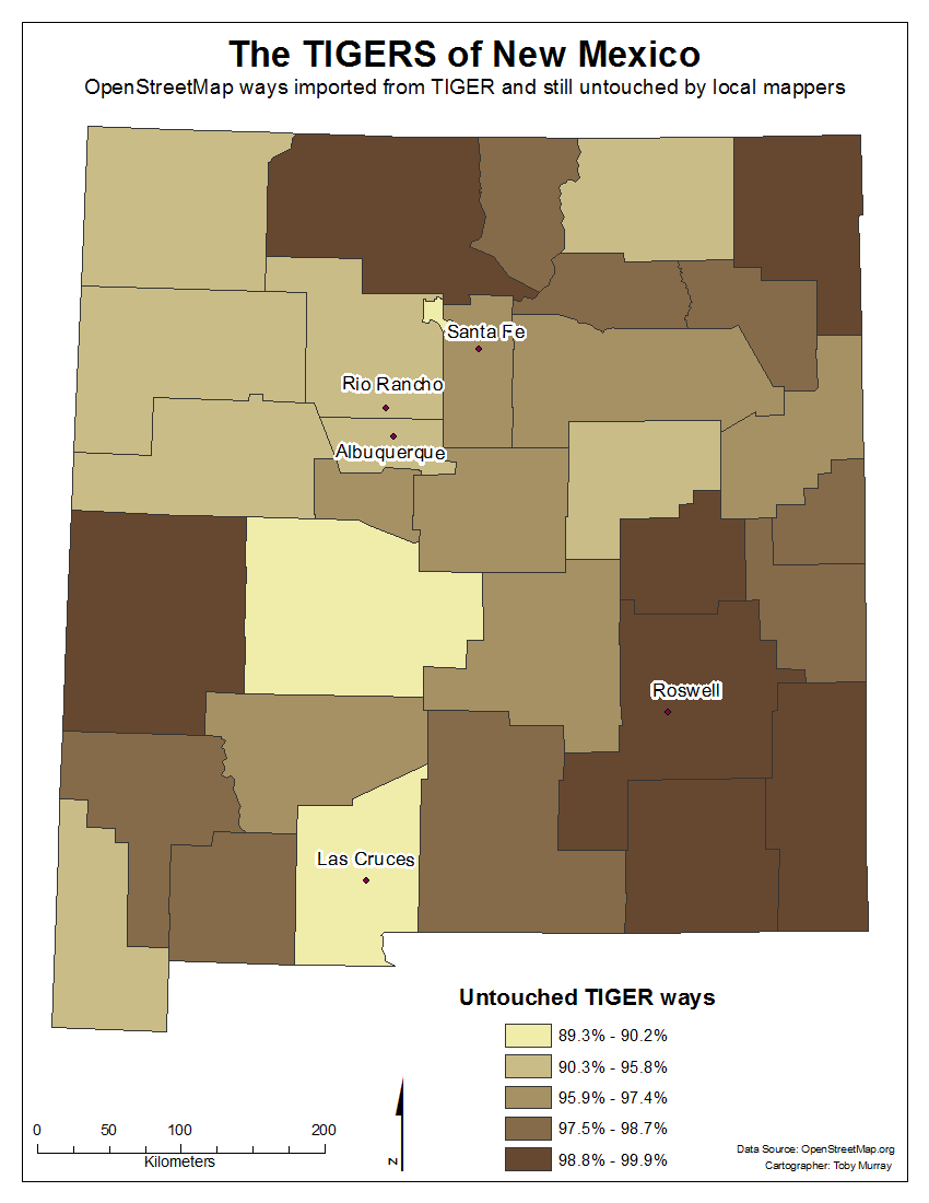
Notice the breakdown here. Looking at the data it would seem that either the TIGER data in New Mexico is nearly perfect and requires no editing or New Mexico is a barren wasteland, incapable of sustaining the fragile life force of mappers. There are no outlying counties and the most heavily edited one (Socorro county) is still sitting at almost 90% untouched. And looking at that county closer, I'm guessing it just doesn't have very many roads and all the editing that has been done there is just related to I-25 that runs right through the middle of the county. Of course this is percentages. As far as total number of TIGER ways touched, McKinley and Bernalillo counties win with 877 and 762 respectively.
OpenHeatMap
Lastly, SeveC pointed me at an interesting website that may be of use once I get my nationwide data lined up: http://www.openheatmap.com/
I went ahead and imported the Colorado data and you can view it here:
http://www.openheatmap.com/view.html?map=FoundlingsFiascoesUngodliest
I found a slight bug in that Broomfield county is missing from OpenHeatMap's database. I chatted with Pete (the admin) about it for a few minutes, until he had to go to participate in an interview for thisweekinmaps. It turns out that he is using census data from 2000 for the county boundaries and Broomfield county didn't yet exist in 2000! I also mentioned to him that it would be nice if state borders were drawn on county based maps and he seemed to agree. There is always something to nitpick, right?
As one of the few New Mexican mappers, I apparently need to step it up… thanks for the visualizations!
ReplyDelete